THE LIVE KRETA · Image & History
Crete in old photos and maps
Real archives, historical names and careful back and forth research.
Added: · approx. 8 minutes read · 12 chapters
1. A statue is a source, not a window without glass
An old photo can immediately make you feel like you see the past as it was. But also a historical camera had a point of view, a cutout and a moment. A card has a maker, purpose and scale. This file helps to read such images and provides concrete entrances to archives. It is at the same time a starting point for our own back-and-now research, without presenting a generated reconstruction as a historical recording.
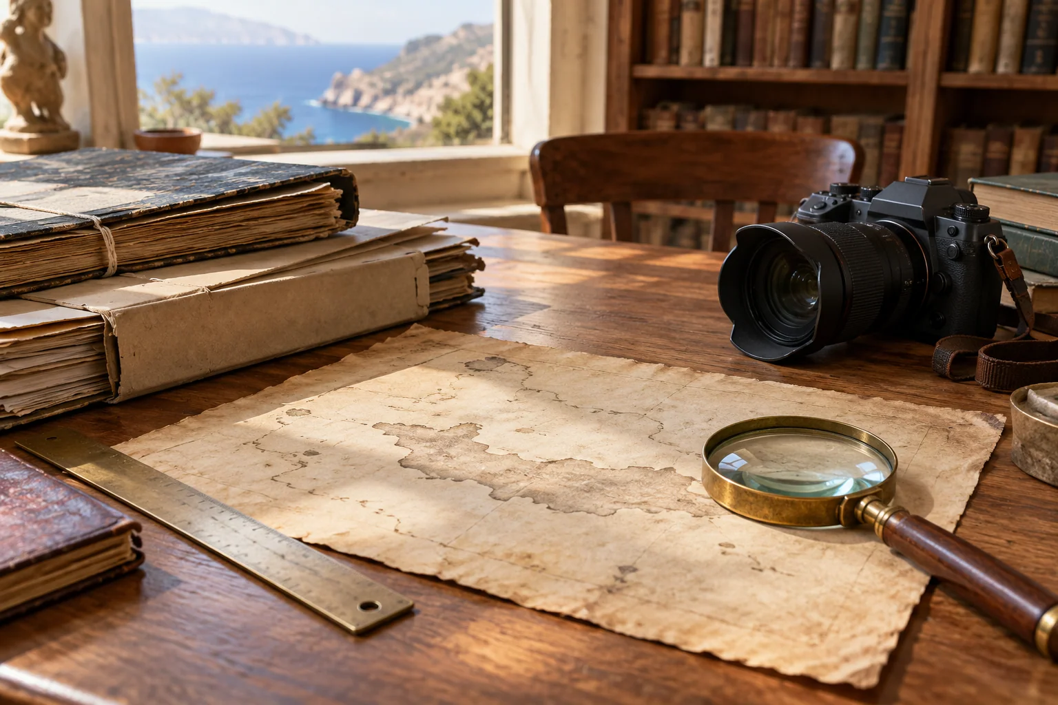
The atmospheric illustration above the article is AI-generated. The separately marked map and archive photo are real reproduced source images. Their dating and creator information follow the mentioned collection data. We don't color them, we don't add buildings and we don't let AI fill out a missing detail.
2. Start describing the archive
A usable image description shall contain at least the title, creator, dating, storage setting and a fixed reference to the record. Note also uncertainty: a date between square brackets is not the same as a date that is on an original negative. Moreover, the moment of digitization is not the date on which the photo was taken.
SearchCulture unlocks material from different settings and refers to the original repository. Use the metadata as input and check the original record when you want to further examine or publish. An aggregation portal makes searching easier, but does not change the origin of the object.
3. Source: Chanioporta, 1933
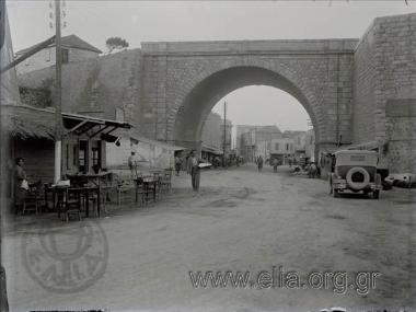
A concrete record concerns the Chanioporta in Heraklion: the gate on the road towards Chania. The name can be misleading if you're only looking for Chania. SearchCulture mentions Georgios Vafiadakis as creator, 1933 as a date and ELIA/MIET as a storage facility. The image license is there as CC BY 4.0 is indicated. [1]
First check the entire recording. Which traffic area, facades and proportions are visible? What's out of the picture? Then write on which parts you want to look back on a current own photo. Below we compare the archive recording with a dated photo from 2014; that second recording is not a live image of 2026. The recorded reproduction is the archive thumbnail; the original description remains accessible via the source link.
4. Then and later: the same environment in 1933 and 2014
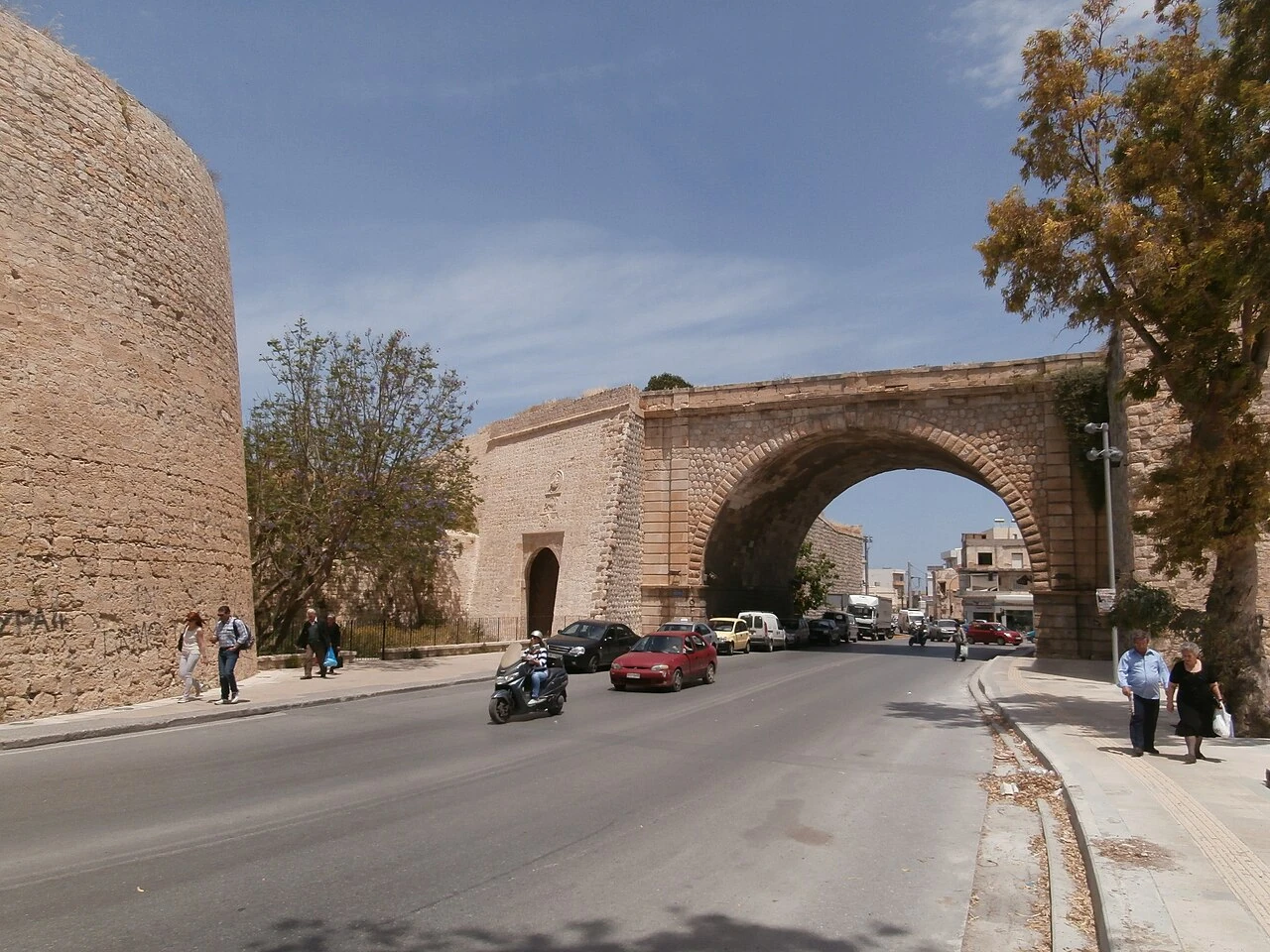
The picture of C messier is according to the file description on 14 May 2014 made and under CC 0 Released. In addition to the wide traffic opening, she also shows the older Pantokrator gate. The municipal heritage project distinguishes this Venetian gate from the traffic opening of the early twentieth century. This distinction prevents us from calling the monumental arch of the archive a sixteenth-century passage. [9] [10]
The two images show the same port environment from different positions. In the recording from 1933 You see the wide bow with the street underneath, people and a car. The later recording shows the arc in a wider traffic environment with road marking and signaling. These are visible differences between the images; they do not determine when each individual change took place. This would require intermediate photos or documents.
We therefore place the photos next to each other, with their own date and maker. The recordings are not pushed across each other: position, angle and cut-out differences too strong for a precise geometric comparison. The photo from 2014 Moreover, a historical snapshot remains in itself, not proof of what the place looks like today.

5. Source window: a face on Chania around 1898
A second record, from the digital archive of the foundation Eleftherios K. Venizelos, called View of Chania. The catalogue indicates the dating as [ 1898 ]. We note this with caution: the hooks are part of the source description. The record mentions a CC BY-NC 4.0 License. In this file we refer to the archive; we do not copy the image as a general free-to-use illustration. [2]
Do not compare the two records as if they are one uniform photo collection. Maker, setting, dating and conditions of use differ. That is precisely the difference: a site with old images is usually not a homogeneous source. Each object has its own course of life and documentation.
6. A real map out 1850
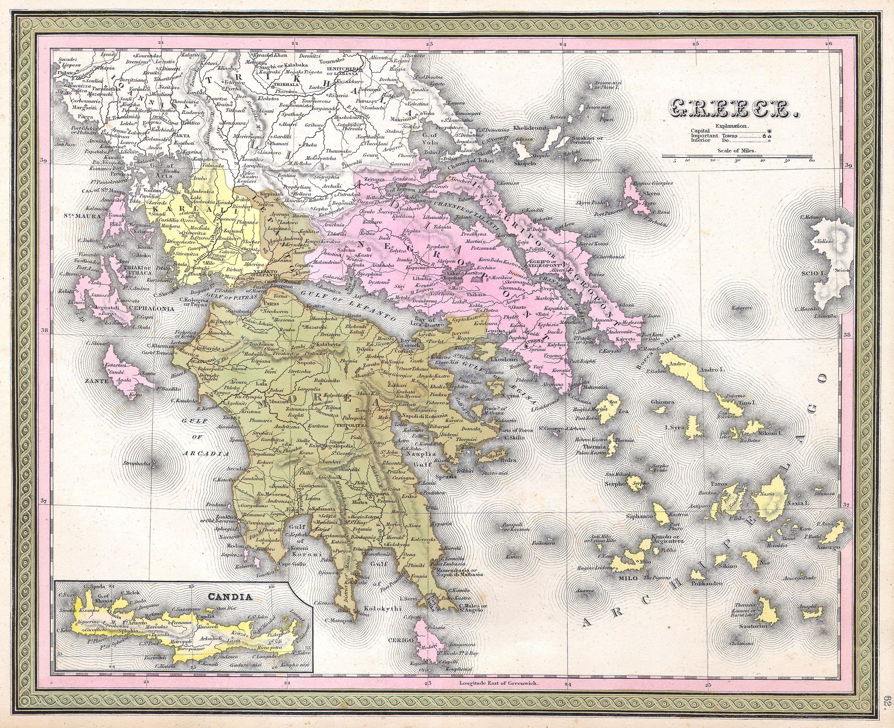
The map Greece of S. August Mitchell out 1850 contains a separate bet of Crete, also referred to as Candia. The reproduced copy is available via Geographicus on Wikimedia Commons with an indication as a public domain. Our recording shows the map as handed down, at reduced resolution, without changing cartographic content. A link opens the entire local image; the source link leads to metadata and the original file. [3]
Pay attention to the ratio between main card and wager. The smaller space for Crete is a choice of the cardmaker. The absence of a village does not automatically mean that the village did not exist. An old card can also reuse older information. The date of publication and the date of the underlying observation need not be the same.
7. Why old cards are so different
A sea chart requires information other than a military map, an administrative map or a topographical map. The names on a map also reflect language and purpose. Candia can refer to the island or city in historical material; therefore read title, legend and context together instead of translating one name separately.
The Historical and Popular Museum of Rethymno shows how important Venetian interest in the island was for its cartographic representation. Defense and governance affected what was captured. The scientific METOPO project focuses on the unlocking and georeferenceing of historical maps of Candia. This illustrates how much research is needed before an old map can be compared with a contemporary map. [4] [5]
8. Then and now: a comparison step by step
Choose one public, accessible position and one historical image with sufficient metadata. Find landmarks that change less quickly than billboards or street furniture: a gate, bend, facade rhythm or mountain silhouette. Check if the recording can be mirrored and if the perspective really fits.
Then take your own photo without entering dangerous or forbidden places. Record date, global location, viewing direction and deviations in position. Put both images next to each other and first describe similarities, then differences. Do not use a perfect slide equation as scale and perspective do not match sufficiently: such an interface can suggest an accuracy that is not there.
9. A fill-in worksheet for image research
| Field | What you're recording |
|---|---|
| Object | Title and stable archive link |
| Creator | Known name or explicitly unknown |
| Date | Exact, estimated or indicated period |
| Location | Definitely recognized or provisional proposal |
| Opinion | Direction, altitude and key landmarks |
| Current recording | Own date and differences in recording position |
| Conclusion | What the images show and what stays open |
| Rights | License, compulsory listing and any restrictions |
10. Photography also has a social history
The Chania Heritage Portal describes the development of photo studios and the role of photographers in capturing people, events and landscape. That reminds me that not everyone came into the picture in the same way. A well-kept studio photo and a street recording answer several questions. [6]
Ask, therefore, who is visible and not visible? A square without women in one photo doesn't prove that women never came. An empty street may have been determined by time, exposure or selection. A carefully built image collection also contains gaps. The power of an archive lies not in omniscience, but in material that enables new questions.
11. Where you can search further
Chania's municipal library offers a digital entrance to books, documents, photos and maps. The University Library of Crete unlocks digitised material for New Greek studies via ANEMI. Both are research inputs; their online availability does not mean that any object may be reused without conditions. [7] [8]
In addition, use the concrete archive records and map collections in the source guide. With your own collection, save one well-described image rather than ten single downloads without origin. A fixed source reference allows later to correct a dating, find a higher resolution or identify a maker.
12. What keeps this file consciously visible
A reproduction, a restoration and a new artistic reconstruction are different things. Scale up or color down can make an old photo more attractive, but does not provide any additional historical evidence for the added details. Our original source images are therefore separately recognizable and their operations are limited to format and file view.
Connect this file to abandoned villages, earthquakes and crafts. A map can show a route or an old place name; a photo can document a workshop or a changed coast. Neither explains the change itself. The interesting step is the combination with text sources, research and carefully appointed uncertainty.
Sources and read on
Sources consulted for this edition on 30 October 2026. Historical publications and dated project descriptions are not a live state of affairs. The practical questions of viewing and research are our editorial reader.
- SearchCulture / ELIA-MIET.Chanioporta, Georgios Vafiadakis, 1933, CC BY 4.0 ↗
- SearchCulture/Venizelos archive, "View of Chania," [ 1898 ], CC BY-NC 4.0 ↗
- Mitchell ( 1850 ), Greece, with commitment Crete... Geographicus / Wikimedia Commons, public domain..
- Historical and Popular Museum of Rethymno maps of Crete
- Forth Metopo and historical maps of Candia.
- Erfgoedportal Chania.. the profession photographer...
- Municipal library Chania.. digital collections
- University Library of Crete
- C Messier Chanioporta and Pantokratoras, 14 May 2014, CC 0 ↗
- Municipal Heritage Project Heraklion 360 Venetian Gate and later traffic opening