THE LIVE KRETA · Geology & landscape
Psiloritis and Sitia: reading Crete in rocks
Two UNESCO geoparks, multiple time scales and one living landscape.
Added: · approx. 6 minutes read · 9 chapters
1. Two landscapes, one way of looking
A geopark is not a collection of loose beautiful stones. It connects geological heritage with education, local communities and the way people use the landscape. Psiloritis and Sitia are both UNESCO Global Geoparks, but they show different sides of Crete. In this file we compare them as two reading areas: the mountain massif in the interior and the eastern landscape of deposits, gorges and caves. [1]
The word geopark must be distinguished from world heritage and from a nature reserve with one uniform access regime. UNESCO recognition does not automatically tell whether each path is open, a cave is freely accessible or a piece of land is public property. The practical rules come from managers and competent authorities. An official area map and up-to-date local information are therefore part of the preparation for a visit.
2. Learn to separate Geological Time from Human Time
A rift can be geologically young and cut through much older rocks. A settlement can have thousands of years of history while the limestone in its walls is much older. With each story, it helps to keep three questions apart: when did the rock come into being, when did the landscape take shape and when did people use this place?
This three-part system prevents a common confusion. A fossil in a rock does not automatically date the path along it. An archaeological find in a cave does not tell when the cave itself was created. So read a landscape as an archive with multiple time scales, in which later processes can cut through older tracks, expose them or move them again.
3. Psiloritis: rock packs and deformation
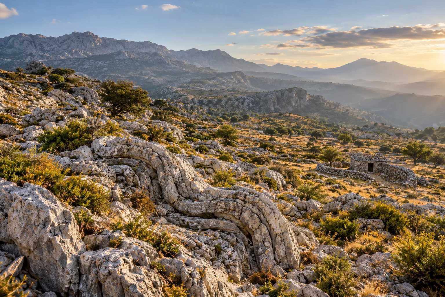
In Psiloritis UNESCO describes a long succession of rocks and a landscape in which tectonics, limestone and karst play a major role. In Vossakos, folds are visible: rock layers that are no longer in their original position due to deformation. It is a useful example to understand why a mountain is not simply one upright pile of undisturbed layers. [2]
At such a dilation, first look at a separate layer. Follow her with your eyes, watch for interruptions and ask which parts really belong together. A color difference does not have to be a time limit, and a visible line does not need to form an active fraction. A detailed interpretation requires geological knowledge; as a visitor you can learn to describe accurately before you explain.
4. Karst: a landscape with a subsurface
Limestone can be dissolved by water. Where water moves along cracks and other passages, larger spaces can be created in the long term. On the surface, for example, you can see closed layers or places where water disappears. Underground caves and passages can be created. These forms explain why the visible river basin does not always coincide with the actual underground waterways.
Our drinking water dossier deals with the consequences for extraction and source protection. This is where the emphasis is on learning to observe. Ask at a dry bed not only where the water has gone, but also what season you see and which rocks lie there. A dry surface is not a full description of the water system.
5. Sites: deposits as landscape history
The official geopark description distinguishes different rock packages and younger sediments in East Crete. It mentions marine deposits with fossils, and shows that the region does not consist exclusively of the same kind of bare limestone mountain. A coastal wall can therefore tell a very different story than a high rock massif. [3]
A fossil has two stories: that of the organism and that of the deposit in which it landed. The presence of sewer fossils on land raises questions about former seas and subsequent lifting. For a concrete rock, that history has to be investigated. Do not take a loose shelly pattern as sufficient evidence for an exact age or water depth.
6. Caves, fossils and people in the east
UNESCO at Sitia emphasizes both the karst system and the fossil-rich deposits as well as the links with settlements and local culture. This also makes the geopark a bridge to our files about Pefki, the Erotokritos and the daily use of the landscape. These compounds are thematic: they do not mean that each cultural use is directly determined by one type of rock. [4]
The geopark's own website opens up separate geosites. Such an inventory is more useful than looking for special stones in a quarry or cave. A place can have scientific, archaeological and ecological values at the same time. Removing a find can destroy the connection that makes her interesting. [5]
7. Two geoparks next to each other
| Read Question | Psiloritis | Sitia |
|---|---|---|
| Spatial entrance | Mountain massif and surrounding valleys | Eastern Crete and the coast |
| Geological accent | Stone sequencing, deformation and karst | Depositions, fossils, caves and gorges |
| Human Connection | Stone construction, shepherd's land and villages | Settlements, local culture and land use |
| Good first source | UNESCO and the Geopark Manager | UNESCO and the Geopark Manager |
| No automatic conclusion | Each rock line is an active fracture | Each cave is freely accessible |
8. Create a field note that remains usable
First write down where you stood and what you really saw. Describe colour, grain, layer shape and orientation in plain words. Add a photo of the context before capturing a detail. A detail without an environment is often difficult to put back later. Also note where your explanation came from: a sign, a guide, a publication or your own suspicion.
Work with two columns: observation and interpretation. For example, in the first one it says that a layer is bent; in the second one you think of a fold. That divorce keeps an excursion report honest and allows to correct something later without losing the original observation.
9. Respect for a vulnerable archive
Leave fossils and rocks in place and follow the indicated access. The geopark website mentions that caves are protected as geological formations and also have archaeological protection in the presence of antiquities. A hiking description is not permission for independent cave visits. [6]
Take a look at this file: the same stone can tell something about an old sea, an underground waterway, a village wall and a craft. Precisely because these stories play on different time scales, the landscape becomes richer. The connection between our files is a reading route, not a replacement for a geological map.
Sources and read on
Sources consulted for this edition on 30 October 2026. Historical publications and dated project descriptions are not a live state of affairs. The practical questions of viewing and research are our editorial reader.